Bachelor thesis topics 2016
Single and crossborehole flow logging experiments
In order to improve the understanding of mechanisms underlying the permeability enhancement in EGS reservoirs a new small scale (10 - 50 m) Stimulation Experiment will be conducted in 2015 - 2016 at the Grimsel Underground Research Laboratory. Pre and post stimulation hydraulic characterization of the field site is an important objective of the reservoir creation research. The fluid logging consists of flushing a borehole with the water with higher or lower conductivity and subsequent measuring of its concentration with time at regular depth intervals. Water flowing into the borehole, either due to “ambient flow” (flow gradient induced by the underground excavation) or “cross-borehole” (flow gradient induced by the opening of neighboring boreholes) conditions, causes dilution of the tracer-rich water column. The flowmeter method allows one to identify the main flowing fractures, their transmissivities in each borehole and to determine the inter-borehole connections. In this thesis, the student will measure and analyze high resolution borehole flow profiles in boreholes drilled into the test volume to characterize pre-stimulation transmissive fracture network.
Supervisors: Maria Klepikova, Mohammadreza Jalali
3D-Flugplanung und Datenanalyse von Luftbildern gewonnen mit Hilfe eines Unmanned Aerial Vehicle (UAV)
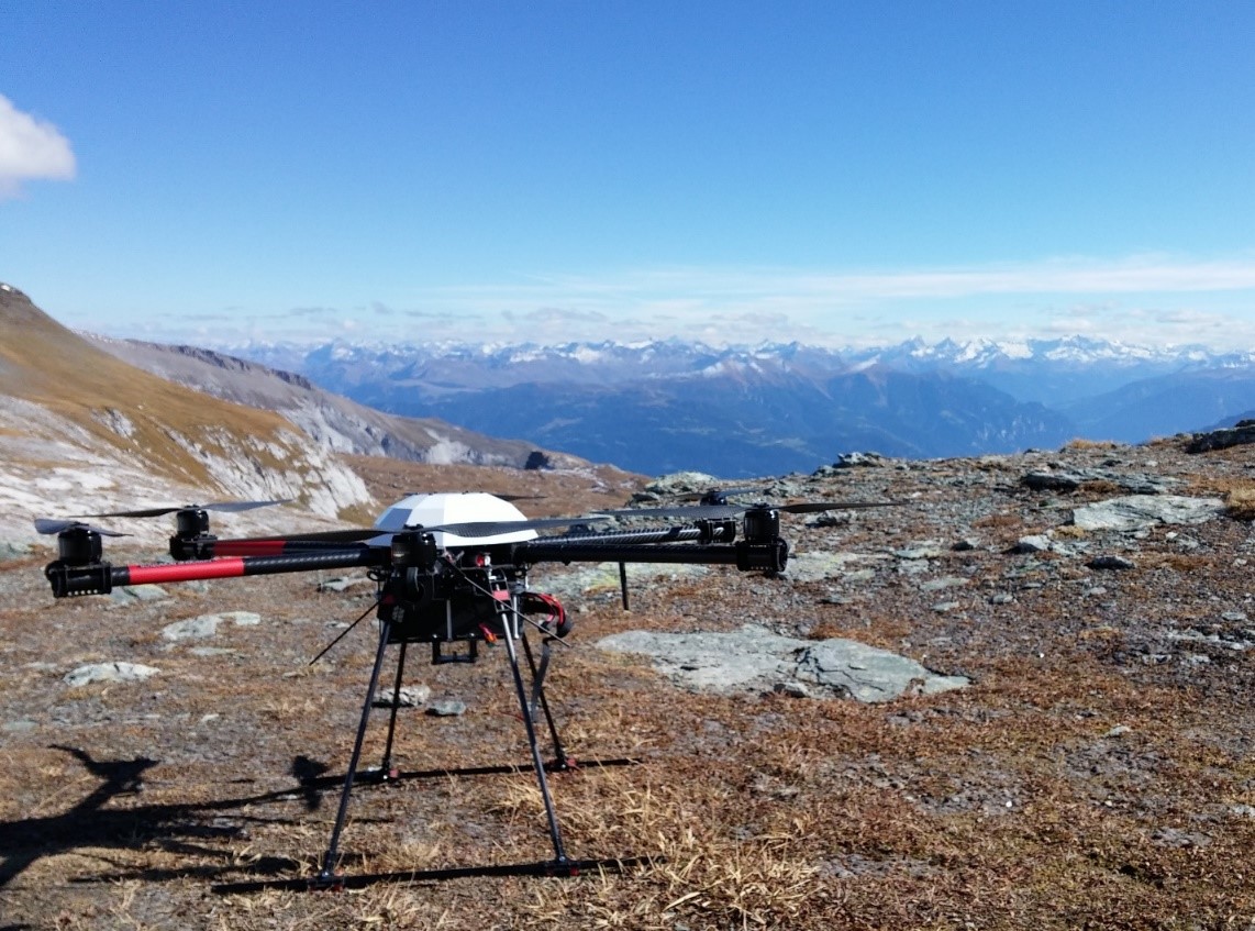
Fernerkundungsdaten spielen in vielen Bereichen wie beispielsweise in der Erkennung und Charakterisierung von Hangbewegungen eine grosse Rolle. Dabei kommen seit wenigen Jahren Unmanned Aerial Vehicles (UAVs) immer mehr zum Einsatz. UAVs können flexibel eingesetzt werden und zum Beispiel hochauflösende und aktuelle Luftbilddaten in schwer oder nicht zugänglichem Gelände gewinnen. Aus Luftbilddaten können dann Orthophotos sowie digitale Höhenmodelle mit verschiedener Software errechnet werden. Diese neuen Daten können dann geologisch interpretiert werden. Die Reichweite von UAVs in Bezug auf Flugzeit und -raum ist allerdings begrenzt und eine optimierte Flugplanung ein sehr wichtiger Schritt hin zu den gewünschten Luftbilddaten.
Diese Arbeit hat zum Ziel
- die 3D-Flugplanung für photogrammetrische Aufnahmen zu verbessern,
- die Qualität der durch unterschiedliche Software gewonnenen Höhenmodelle an Hand von zwei Fallstudien aus den Schweizer Alpen zu vergleichen,
- und optional geologische Strukturen aus Luftbildern und Höhenmodellen zu gewinnen.
Neben existierenden Daten werden wir mit dem/der Kandidaten/in auch selbst mit unserem Lehrstuhl-eigenen UAV fliegen und die neuen Flugroutinen testen. Wir arbeiten dich in verschiedene Software ein.
Betreuer: Martin Ziegler, Andrea Wolter, Andrea Manconi
3-D Analysis of Hydraulic and Mechanic Fracture Propagation
Natural and hydraulically-induced fractures play a crucial role in different disciplines, including hydrogeology, oil and gas industry, waste disposal and geothermal industry. The presence of discontinuities increases rock mass heterogeneity and fluid/heat transport non-linearity in fractured rock masses. Studying the formation mechanisms and resulting fracture geometry in 3D will yield more insights into the propagation behavior of natural and induced fractures, which are important, e.g., for engineering a thermal heat exchanger of an Enhanced/Engineered Geothermal System (EGS).
This BSc thesis will focus on the study of the underlying mechanisms of brittle, hydraulic fracture propagation in crystalline rocks. A combination of field work and numerical modelling are offered in this proposal to evaluate two relevant types of fractures, i.e.,
- hydraulically-induced fractures for stress measurement at the Grimsel deep underground rock laboratory, and
- natural exfoliation fractures previously identified in the Grimsel region of the Swiss Alps that show stepwise fracture propagation and to some extent mimic hydraulic fractures.
Supervisors: Mohammadreza Jalali, Martin Ziegler
Evaluation of geometric distortions of space-borne SAR acquisitions
Differential Synthetic Aperture Radar Interferometry (DInSAR) is a powerful remote sensing technique capable to retrieve ground displacement in different scenarios. Space-borne DInSAR relies on the availability of images acquired from SAR sensor on board satellites orbiting 800 km above the Earth’s surface. By analyzing the phase differences between two subsequent acquisitions over the same area it is possible to retrieve surface deformation relevant to natural and/or anthropic phenomena with sub-centimetric accuracies.
Due to the satellite’s acquisition geometry and other intrinsic limitations of the DInSAR technique, current SAR sensors can image only a portion of active slope processes. In this thesis project, the European Space Agency SAR data (ERS-1, ERS-2 and Envisat) acquired in the period 1992-2010 will be exploited. Considering the satellite’s viewing geometry parameters and available Digital Elevation models, the main task will be to simulate geometric distortions of SAR acquisitions (using QGIS, http://www.qgis.org/). The results obtained will be compared to inventories of landslide phenomena, in order to quantify the suitability of available SAR data in different mountain regions (statistical analysis will be performed with Excel and/or Matlab).
Supervisors: Andrea Manconi, Benedetta Dini
DInSAR processing on the Cloud: use of ESA Geohazard Exploitation Platform (GEP) for the investigation of surface deformation phenomena
Differential Synthetic Aperture Radar Interferometry (DInSAR) is a powerful remote sensing technique capable to retrieve ground displacement in different scenarios. Space-borne DInSAR relies on the availability of images acquired from SAR sensor on board satellites orbiting 800 km above the Earth’s surface. By analyzing the phase differences between two subsequent acquisitions over the same area it is possible to retrieve surface deformation relevant to natural and/or anthropic phenomena with sub-centimetric accuracies.
The Geohazards Exploitation Platform (GEP) aims at supporting the exploitation of satellite data for geo-hazards investigation, including DInSAR processing. The platform is meant to allow users to easily exploit Earth Observation data resources by combining fast data access, processing facilities and flexibility for the users data analysis. Data Processing Services enable to process on the Cloud platform the data available in the repository by using a number of well know tools and to exploit the results. In this thesis project, the student will use the GEP service to process space borne SAR data and retrieve surface deformation over different areas. The obtained surface velocity maps and displacement time series will be analyzed and validated by considering available catalogues of geo-hazard phenomena and/or independent observations. Basic knowledge of Matlab is required.
Supervisor: Andrea Manconi
Image processing to retrieve surface deformation in active slope areas
The investigation of surface displacements is crucial for the analysis and interpretation of several geo-hazards. For this purpose, several in situ and remote sensing approaches can be applied depending on the specific scenario. In recent years, image processing algorithms (feature tracking, pixel-offset, and optical flow) have been extensively applied on optical images and videos to evaluate and measure displacements caused by different geologic phenomena, including landslides.
In this thesis project, the student will apply the image processing techniques to different datasets of optical images (space-borne, airborne, and terrestrial) acquired in active slope regions. The results obtained with the image processing will be analyzed and validated by using independent data, where available. Basic knowledge of Matlab is required.
Supervisor: Andrea Manconi, Andrea Wolter
Petrological and photogrammetric analysis of the Flims Slide sliding zone
The prehistoric Flims Slide, the largest landslide in Europe, has been studied for centuries, yet it still holds many mysteries related to its failure mechanisms and processes. The slide debris is characteristically fractured and fragmented, and has been classified into different deposit zones. However, the material in the sliding zone has not been thoroughly investigated. In this thesis, the student will analyse thin sections and three-dimensional photogrammetry models taken from the sliding zone to better characterize the processes occurring at the bedrock-sliding mass interface. Petrographic descriptions, with the possibility of XRD analysis, will be implemented to assist the interpretation of micro-scale fracturing and crushing processes.
Supervisor: Dr. Andrea Wolter; Prof. Simon Löw
Analysis of geomorphic processes affecting the catastrophic Flims Slide and beyond
The area of the prehistoric Flims Slide has been and is affected by many surface and subsurface processes. An important component in understanding mass movements in the area, including the unique Flims Slide, is a better characterisation of processes that could have influenced the event, both before and during the landslide. In the proposed thesis, the student will map and analyse geomorphic processes that have shaped the Flimserstein, developing a landform symbology that will be applied internationally and using traditional field surveys and aerial images captured from a UAV (Unmanned Aerial Vehicle).
Supervisor: Dr. Andrea Wolter, Prof. Marco Giardino (U. Torino), Danilo Moretti (U. Cantebury)
Recent or prehistoric movement? Forensics of an active landslide in Ticino
The Cerentino instability in Ticino has been creeping for decades. However, an obvious, weathered sliding scar in the proximal area of the landslide suggests longer term movement. In the proposed thesis the student will characterise this sliding scar using geomorphic and structural mapping, photogrammetry, and possibly cosmogenic nuclide dating. The goal of the thesis will be to determine the settings, history, and evolution of the Cerentino landslide, including estimation of age of the sliding scar, as well as to better understand the geological situation of the landslide. This thesis is part of a larger research project characterising the Cerentino instability.
Supervisor: Dr. Andrea Wolter, Prof. Simon Löw
The long-term strength of limestone: Crack Initiation or Crack Propagation?
The design of underground openings for long-term underground excavation stability requires an estimate of the long-term strength of rock. Back analysis of underground openings suggests that the long-term strength should be close to the crack initiation (CI) threshold determined in laboratory compression tests. The CI threshold is typically 30-40% of the unconfined compressive strength (UCS). However, typical laboratory tests to determine long-term properties indicate that the long-term strength is closer to 65-75% of the UCS, which closer to the crack propagation (CD) threshold.vbOne possible reason will be investigated in this thesis, the influence of sample geometry.
In order to understand the static loads to apply, baseline compressive testing must be conducted. This will establish the damage thresholds, which include CI, CD and UCS. The baseline UCS tests on prismatic samples will be used to determine the long-term load thresholds for the static load testing. Samples will be loaded at different percentages of the baseline UCS values (between CI and CD) to determine the minimum static load to cause failure.
The main goals of the thesis are to establish baseline strength values and to understand the influence of sample geometry on the long-term strength of limestone.
Supervision: Dr. Matthew Perras
Relaxation Testing of Prismatic Limestone Samples
This thesis will investigate the role of sample geometry on the laboratory relaxation process by testing prismatic samples and comparing these results with the cylindrical samples previously tested. In order to determine the different thresholds for the relaxation tests, baseline compression tests will be conducted on prismatic samples. The thresholds will be selected to be between the crack initiation (CI) and crack propagation (CD) damage levels. These damage levels will be determined from the compression tests based on strain measurements.
Relaxation tests will be conducted in a computer controlled servo hydraulic compression frame. Each test is anticipated to take between 24 and 48 hours to complete. Five to ten samples will be required to determine if the relaxation behavior remains constant (with lower magnitudes of relaxation) as the strain threshold for loading is decreased.
The main goals of the thesis are to establish baseline strength values of prismatic samples and to understand the influence of sample geometry on relaxation behavior of limestone. The main outcome will be to demonstrate that the relaxation process is independent or dependent on the sample geometry.
Supervision: Dr. Matthew Perras
Assessment of deep-seated landslide distributions in the Alps (Two possible topics: Valais and Ticino)
Gaining a better understanding of processes that contribute to the formation of large rock slope failures can provide important insight into their mechanics and future development throughout the Alps. Such instabilities are commonly assumed to be initiated as a result of erosion, seismic activity, or a change in rainfall patterns. They are not have not yet been tied to the migration of waterfalls or erosion by rivers, although many intersect river networks throughout the region.
In two parallel projects we will map large landslides in Cantons Valais and Tichino, and compare their distribution to lithological boundaries, tectonic faults, former glacier extents, and patterns of drainage and waterfalls across the regions. We will use a combination of engineering geological and geomorphological mapping, as well as GIS, and regional results from space-borne DInSAR analyses produced in a companion bachelor topic (see above). Knowledge of GIS, Excel, and/or Matlab would be useful though is not necessary.
Supervisor: Kerry Leith
Tracer tests in Fractured Geothermal Reservoir
In order to improve the understanding of mechanisms underlying the permeability enhancement in EGS reservoirs a new small scale (10 - 50 m) Stimulation Experiment will be conducted in 2015 - 2016 at the Grimsel Underground Research Laboratory. Pre and post stimulation hydraulic characterization of the field site is an important objective of the reservoir creation research. An estimation of key transport parameters for estimating production longevity such as the surface area and volume of flow paths linking the wells, can be studied through the use of tracer migration experiments. Tracer tests generally involve the injection of solutes into one or more injection wells, and monitoring of tracer returns in fluids produced from offset observation wells (cross-borehole) or the injection well itself (push-pull) wells. In this thesis, the student will conduct solute tracer tests and analyze the data through numerical modelling in order to characterize transport properties of pre-stimulation fracture network.
Supervisor: Maria Klepikova, Mohammadreza Jalali
Untersuchung einer aktiven Hangbewegung am grossen Aletschgletscher mittels digitaler Bildanalyse
Seit September 2013 überwacht die Gruppe Ingenieurgeologie die Bewegungen der Talflanken im Bereich der Gletscherzunge des grossen Aletschgletschers im Wallis. Die Überwachungsanlage besteht aus 2 Totalstationen, Meteostationen, permanenten GPS Stationen und mehreren Kameras. Das grossräumige Gebiet umfasst stabile Hänge, aber auch einzelne Instabilitäten. Im Mai 2015 beschleunigten sich plötzlich die Bewegungen im Hangbereich oberhalb der zu dieser Zeit schnell schmelzenden Gletscherzunge (bei Silbersand) und erreichten Geschwindigkeit von über 4 cm pro Stunde. Eine Webcam fotografiert seit Juli 2015 das Rutschgebiet periodisch, wodurch Bewegungen eindrücklich gezeigt und erfasst werden können. Zwei weitere hochauflösende Kameras, die photogrammetrische Bildpaare aufnehmen, wurden im September 2015 installiert. Diese ermöglichen mittels Photogrammetrie eine 3D Analyse der geologischen Strukturen und Bewegungsvektoren des sich bewegenden Hangs.
Diese Arbeit beinhaltet
- Erstellung von photogrammetrischen Modellen und Strukturanalyse (Morphologie, Trennflächen) der Rutschung Silbersand
- Berechnung von 3D Verschiebungsvektoren im Zeitraum Juli bis Oktober aus den photogrammetrischen Modellen
- Verglich der photogrammetrisch ermittelten Bewegungsvektoren mit unabhängigen Daten aus der geodätischen Vermessung
- Analyse von Zeitreihen der Hangbewegung mittels „Pixel-Offset Maps“ (optional)
Je nach Schnee- und Wetterlage im Zeitraum der Bachelorarbeit ist auch eine Besichtigung im Feld möglich.
Betreuer: Franziska Glüer, Simon Löw
Historische Untersuchung der Moosfluh-Hanginstabilität am grossen Aletschgletscher
Verursachen zurückschmelzende Gletscher Hangbewegungen? Welchen Einfluss hat der zurückschmelzende grosse Aletschgletscher auf die Stabilität und Bewegungen der Moosfluh-Hanginstabilität? Durch Auswertung von Luftbildern aus der Bildsammlung von Swisstopo soll eine Grundlage geschaffen werden, die eine gezielte Untersuchung einer grossen Hanginstabiltät im Bereich der Gletscherzunge des grossen Aletschgletschers erlaubt. Im Untersuchungsgebiet liegen sehr viele historischen Karten und Luftbildern seit 1947 bis heute vor. Diese Luftbilder müssen georeferenziert werden und anschliessend bezüglich Morphologie, Tektonik und Glaziologie interpretiert werden. In den flächendeckenden und räumlich hochauflösenden Bildern werden für den Betrachter Rutschungsphänomene und Zusammenhänge mit geologischen Einheiten und Strukturen sichtbar, aber auch zeitliche Veränderungen. Da sich die Hanginstabilität von Moosfluh mit grosser Geschwindigkeit bewegt, sind auf den Luftbildern vermutlich direkt Hakenwurf-Phänomene, Öffnungen von Gräben und Verschiebungen von Felsrippen erkennbar. Zusätzlich untersucht werden sollen zerstörte Wanderwege, plötzlich auftretende Kahlflächen, neue Felsstufen und der Rückzug der Gletscherzunge.
Diese Arbeit beinhaltet
- Ermittlung der wesentlichen Datensätze (u.a. Stereopaare, Orthobilder) aus dem vorhandenen Katalog an Luftbildern und terrestrischen Aufnahmen von 1947 bis heute,
- Ausgewählte Bilder entzerren und georeferenzieren,
- Kartieren und analysieren der Phänomene und Hangbewegungen von Moosfluh seit 1947 entlang der zurückschreitenden Gletscherzunge des grossen Aletschgletschers,
- Vergleich mit den Bewegungen der letzten 20 Jahre abgeleitet aus Satellitendaten und Luftbild-Photogrammetrie (Strozzi et al. 2010)
Je nach Schnee- und Wetterlage im Zeitraum der Bachelorarbeit ist auch eine Besichtigung im Feld möglich.
Betreuer: Franziska Glüer, Simon Löw
Structural and kinematic characterization of the Belalp Sackung
The Belalp Sackung is an example of a deep-seated slope instability that became active during deglaciation at the end of the last ice age. It is located about 3 km southwest and downstream of the terminus of the Aletsch Glacier. It also lies along the same slope and in similar geological conditions as present-day active instabilities related to rapid retreat of the Aletsch Glacier. Signs of active slope deformation at the Belalp Sackung include an active debris flow channel bounding the instability to the northeast. Apart from this, it is uncertain if the entire Sackung body is actively deforming. The goal of this BSc Thesis is to map boundaries of the instability and delineate distinct compartments with field mapping, as well as aerial photo and DTM analysis. Structural characterization of foliation, large-scale discontinuities and small-scale fractures will provide an important basis for deriving structural control on and kinematic behavior of individual compartments. The geological and geomorphological models from these investigations will be compared to present-day instabilities in the same geological context upstream in the region of current Aletsch Glacier retreat. The study is thus a contribution to understanding the relationship between deglaciation and landslide hazards.
Supervisors: Dr. Valentin Gischig, Dr. Andrea Wolter
Analysis of micro-seismicity recorded during hydraulic fracturing for stress field characterization at the Grimsel Test Site
To characterize local stress conditions multiple hydraulic fracturing experiments were performed in two 20 m deep boreholes in the Grimsel Test Site. Microseismicity accompanying these hydraulic fractures was recorded using a 32-channel monitoring system in triggered mode. In addition, half of the channels were recorded continuously. With the triggered system, on the order of 10 - 100 events were recorded during most of these hydraulic fractures. The 3D distribution of the seismic sensors in nearby tunnels and boreholes and the close proximity of the sensors to the hydraulic fracturing experiments (sensor distance 5-70 m) yielded a high-quality data set that will allow to study the mechanisms of induced seismicity during fracturing. Goal of this project is to: 1) Manually pick P-wave first arrivals to improve location accuracy, 2) investigate the impact of the seismic velocity model (anisotropic, heterogeneous) on the spatial distribution of the seismicity, and 3) analyze the spatial and temporal patterns of the seismicity clouds and interpret it towards the physical driving mechanisms leading to these seismic events.
Supervisors: Dr. Valentin Gischig, Dr. Joseph Doetsch
Borehole logging data analysis and integration into the geological model of the Grimsel Stimulation experiment
Currently, a decameter-scale fault stimulation experiment is being planned at the Grimsel underground rock laboratory run by NAGRA. The goal is to inject water at high pressures into a fault zone and to induce slip. During the initial rock mass characterization phase that ended in November 2015, different borehole logs (optical televiewer, electric resisitivity, spectral gamma, full waveform sonic) were run in several boreholes to obtain rock physical parameters and structural information. The goal of this BSc thesis is to analyze these data and to integrate them with core observations, geophysical images, and laboratory experiments towards an improved rock mass model.
Supervisors: Valentin Gischig, Hannes Krietsch
Comparison of Fracture Characteristics from Different Rocks
Nuclear waste storage repositories, co2 sequestration sites and oil and gas reservoirs are heavily influenced by fracture networks, as rock fractures are main planes of weakness in rock mass and can contribute significantly to fluid transport. Understanding the fracture characteristics of different rocks types will help to better develop site where fluid flow is of interest, either to minimize or enhance. The main fracture characteristics of relevance are typically normal and shear strength for the mechanical properties and fracture conductivity for fluid flow processes.
In this thesis fracture characteristics for 3 to 4 rock types (e.g., gneiss, limestone) will be investigated. The study will involve site selection, sampling of the rock in situ, laboratory testing of rock strength and post testing fracture analysis. Common laboratory tests will be used to draw comparisons between fractures generated in the different rock types.
Supervisor: Dr. Matthew Perras